-
Start0 miFrom Smithy Bridge head around the bowling green, cricket pitch, and towards the Village HallDistance from previous: 0 miOS Grid Ref: SK 26288 91863Latitude: 53° 25′ 22″ NLongitude: 1° 36′ 21″ WElevation: 522.31 ft
-
Woodfall Lane0.05 miTurn left onto Woodfall LaneDistance from previous: 0.05 miOS Grid Ref: SK 26364 91866Latitude: 53° 25′ 22″ NLongitude: 1° 36′ 17″ WElevation: 525.92 ft
-
Post Office0.12 miFollow the track passed the tennis courts and into the woods. The PO has a great shop, café, etc - lovely cakes :)Distance from previous: 0.07 miOS Grid Ref: SK 26348 91985Latitude: 53° 25′ 26″ NLongitude: 1° 36′ 17″ WElevation: 532.15 ft
-
Bridge0.23 miGo right across and up the stepsDistance from previous: 0.11 miOS Grid Ref: SK 26263 92144Latitude: 53° 25′ 31″ NLongitude: 1° 36′ 22″ WElevation: 547.57 ft
-
Steps0.24 miFollow the clear track up hillDistance from previous: 0.01 miOS Grid Ref: SK 26276 92149Latitude: 53° 25′ 31″ NLongitude: 1° 36′ 21″ WElevation: 547.57 ft
-
Smallfield Lane0.34 miCross the road, up the small stone steps and through the iron gateDistance from previous: 0.1 miOS Grid Ref: SK 26366 92276Latitude: 53° 25′ 35″ NLongitude: 1° 36′ 16″ WElevation: 646 ft
-
Church Gate0.64 miGo out and back in the first gate to enter the church yard and pass in front of the buildingDistance from previous: 0.3 miOS Grid Ref: SK 26749 92533Latitude: 53° 25′ 44″ NLongitude: 1° 35′ 56″ WElevation: 851.38 ft
-
St Nicholas' Church0.67 miTurn right at the end of the Bell Tower on the clear path.Distance from previous: 0.03 miOS Grid Ref: SK 26693 92527Latitude: 53° 25′ 43″ NLongitude: 1° 35′ 59″ WElevation: 845.47 ft
-
Graveyard0.7 miTurn left on the path that leads East through the graveyard.Distance from previous: 0.03 miOS Grid Ref: SK 26691 92563Latitude: 53° 25′ 45″ NLongitude: 1° 35′ 59″ WElevation: 877.62 ft
-
Gate0.74 miGo through the gate and carry on the pathDistance from previous: 0.04 miOS Grid Ref: SK 26619 92561Latitude: 53° 25′ 45″ NLongitude: 1° 36′ 3″ WElevation: 875.66 ft
-
Bailey Hill0.8 miExit the grave yard and go right, down hill, at Bailey Hill, so that the steep edge is directly on your left.Distance from previous: 0.06 miOS Grid Ref: SK 26530 92590Latitude: 53° 25′ 45″ NLongitude: 1° 36′ 7″ WElevation: 858.92 ft
-
Turn1 miTake the 90 degree left down the hillDistance from previous: 0.2 miOS Grid Ref: SK 26612 92900Latitude: 53° 25′ 55″ NLongitude: 1° 36′ 3″ WElevation: 850.07 ft
-
Rocher End Brook1.08 miCross the brook and take the path up into the field directly in frontDistance from previous: 0.08 miOS Grid Ref: SK 26522 92948Latitude: 53° 25′ 57″ NLongitude: 1° 36′ 8″ WElevation: 759.19 ft
-
Broken Wall1.12 miCross the wall and carry on up hill. Various lines hereDistance from previous: 0.04 miOS Grid Ref: SK 26486 93002Latitude: 53° 25′ 59″ NLongitude: 1° 36′ 10″ WElevation: 815.94 ft
-
Bowsen1.23 miBear right at the stone bar onto the clear track behindDistance from previous: 0.11 miOS Grid Ref: SK 26406 93156Latitude: 53° 26′ 4″ NLongitude: 1° 36′ 14″ WElevation: 957.02 ft
-
Stone Bench1.27 miTurn right at the stone bench and go up the hill on the clear track wayDistance from previous: 0.04 miOS Grid Ref: SK 26422 93216Latitude: 53° 26′ 6″ NLongitude: 1° 36′ 13″ WElevation: 1018.04 ft
-
Rocher Wood1.29 miTurn almost 180 left to go on the path along the edgeDistance from previous: 0.02 miOS Grid Ref: SK 26467 93212Latitude: 53° 26′ 6″ NLongitude: 1° 36′ 11″ WElevation: 1049.87 ft
-
Gate1.54 miDistance from previous: 0.25 miOS Grid Ref: SK 26193 93504Latitude: 53° 26′ 15″ NLongitude: 1° 36′ 25″ WElevation: 1166.67 ft
-
Gate1.7 miDistance from previous: 0.16 miOS Grid Ref: SK 25982 93654Latitude: 53° 26′ 20″ NLongitude: 1° 36′ 37″ WElevation: 1185.04 ft
-
Bench1.75 miTurn left before the bench down the hillDistance from previous: 0.05 miOS Grid Ref: SK 25916 93669Latitude: 53° 26′ 20″ NLongitude: 1° 36′ 40″ WElevation: 1145.34 ft
-
Rocher Head1.89 miTurn right on the clear track wayDistance from previous: 0.14 miOS Grid Ref: SK 25740 93555Latitude: 53° 26′ 17″ NLongitude: 1° 36′ 50″ WElevation: 935.04 ft
-
Smallfield Lane 22.15 miCross the road and go over the stile oppositeDistance from previous: 0.26 miOS Grid Ref: SK 25443 93760Latitude: 53° 26′ 24″ NLongitude: 1° 37′ 6″ WElevation: 1005.91 ft
-
Bar Dike2.86 miTurn left towards Mortimer RoadDistance from previous: 0.71 miOS Grid Ref: SK 24625 94516Latitude: 53° 26′ 48″ NLongitude: 1° 37′ 50″ WElevation: 1166.34 ft
-
Mortimer Road2.91 miCross the road and go through the gate on the clear "Dukes Road" on Broomhead MoorDistance from previous: 0.05 miOS Grid Ref: SK 24556 94501Latitude: 53° 26′ 48″ NLongitude: 1° 37′ 54″ WElevation: 1175.52 ft
-
Hurrkling Edge3.34 miGreat shelter among the stones about 50m to the left of the pathDistance from previous: 0.43 miOS Grid Ref: SK 23902 94728Latitude: 53° 26′ 55″ NLongitude: 1° 38′ 29″ WElevation: 1305.12 ft
-
Last wall3.75 miPass the high fell wall on the leftDistance from previous: 0.41 miOS Grid Ref: SK 23262 94877Latitude: 53° 27′ 0″ NLongitude: 1° 39′ 4″ WElevation: 1313.32 ft
-
Rushy Dike4.05 miCan be a ford at certain times of yearDistance from previous: 0.3 miOS Grid Ref: SK 22775 94848Latitude: 53° 26′ 59″ NLongitude: 1° 39′ 30″ WElevation: 1330.71 ft
-
Flint Hill4.78 miDistance from previous: 0.73 miOS Grid Ref: SK 21666 94641Latitude: 53° 26′ 53″ NLongitude: 1° 40′ 30″ WElevation: 1545.93 ft
-
Cartledge Brook5.76 miTake the much fainter path off the right, following the Northern bank of the brookDistance from previous: 0.98 miOS Grid Ref: SK 20766 93404Latitude: 53° 26′ 13″ NLongitude: 1° 41′ 19″ WElevation: 1562.01 ft
-
Ford6.43 miCross the brook and go up the clough along the line of grouse butts in a South-westerly directionDistance from previous: 0.67 miOS Grid Ref: SK 19930 94027Latitude: 53° 26′ 33″ NLongitude: 1° 42′ 5″ WElevation: 1647.64 ft
-
Picnic tables (!?)6.6 miJust before the tables take the path on the left out of the clough onto Robin Hood Moss then follow the line of buttsDistance from previous: 0.17 miOS Grid Ref: SK 19709 93897Latitude: 53° 26′ 29″ NLongitude: 1° 42′ 17″ WElevation: 1687.66 ft
-
Wet Stones7.12 miAt the last stones bear right of the well built butts to meet Howden EdgeDistance from previous: 0.52 miOS Grid Ref: SK 19037 93773Latitude: 53° 26′ 25″ NLongitude: 1° 42′ 53″ WElevation: 1775.26 ft
-
Howden Edge7.26 miGo right on the clear path heading NorthDistance from previous: 0.14 miOS Grid Ref: SK 18850 93814Latitude: 53° 26′ 26″ NLongitude: 1° 43′ 3″ WElevation: 1735.56 ft
-
High Stones7.62 miThe small cairn to the right is the highest point in South YorkshireDistance from previous: 0.36 miOS Grid Ref: SK 18783 94381Latitude: 53° 26′ 45″ NLongitude: 1° 43′ 7″ WElevation: 1797.24 ft
-
Wilfrey Neild8.36 miNatural gritstone window om Wilfrey EdgeDistance from previous: 0.74 miOS Grid Ref: SK 18788 95488Latitude: 53° 27′ 20″ NLongitude: 1° 43′ 6″ WElevation: 1686.68 ft
-
Wilfrey Edge8.46 miTurn right and take one of the fainter paths out towards the visible Margery StonesDistance from previous: 0.1 miOS Grid Ref: SK 18726 95622Latitude: 53° 27′ 25″ NLongitude: 1° 43′ 10″ WElevation: 1752.95 ft
-
Margery Stones8.61 miDistance from previous: 0.15 miOS Grid Ref: SK 18962 95652Latitude: 53° 27′ 26″ NLongitude: 1° 42′ 57″ WElevation: 1774.61 ft
-
Trig Point8.65 miMargery Hill. Believed to have been part of a Bronze Age burial mound.Distance from previous: 0.04 miOS Grid Ref: SK 18907 95693Latitude: 53° 27′ 27″ NLongitude: 1° 43′ 0″ WElevation: 1774.61 ft
-
Cut Gate End8.95 miCross the much clearer cut gate and carry onDistance from previous: 0.3 miOS Grid Ref: SK 18589 96056Latitude: 53° 27′ 39″ NLongitude: 1° 43′ 17″ WElevation: 1731.63 ft
-
Ford9.33 miDistance from previous: 0.38 miOS Grid Ref: SK 18283 96573Latitude: 53° 27′ 56″ NLongitude: 1° 43′ 33″ WElevation: 1702.43 ft
-
Trig Point9.78 miEither carry strait on to Outer Edge...or take the hard left to Crow Stones and loop backDistance from previous: 0.45 miOS Grid Ref: SK 17706 96972Latitude: 53° 28′ 9″ NLongitude: 1° 44′ 5″ WElevation: 1773.29 ft
-
Fords10.47 miMultiple small fords here. Path disappears. The line is always to the highest groundDistance from previous: 0.69 miOS Grid Ref: SK 17351 97930Latitude: 53° 28′ 40″ NLongitude: 1° 44′ 24″ WElevation: 1613.85 ft
-
Harden Moss11.07 miDistance from previous: 0.6 miOS Grid Ref: SK 16435 98238Latitude: 53° 28′ 50″ NLongitude: 1° 45′ 13″ WElevation: 1641.73 ft
-
Hoar Stones11.62 miPass the distinctive three Hoar Stones about 100m on your leftDistance from previous: 0.55 miOS Grid Ref: SK 15574 98326Latitude: 53° 28′ 53″ NLongitude: 1° 46′ 0″ WElevation: 1682.09 ft
-
Featherbed Moss12.5 miTurn left and head south towards the source of the River Derwent in the valley belowDistance from previous: 0.88 miOS Grid Ref: SK 14215 98660Latitude: 53° 29′ 4″ NLongitude: 1° 47′ 14″ WElevation: 1644.36 ft
-
Hoar Clough Head12.77 miBear left on the last clough towards Shepheards Meeting StonesDistance from previous: 0.27 miOS Grid Ref: SK 14166 98239Latitude: 53° 28′ 50″ NLongitude: 1° 47′ 16″ WElevation: 1615.16 ft
-
Shepheards Meeting Stones12.9 miCross Hoar Clough (scramble) and take the path directly south, down hill, on the far bank. Excellent natural shelterDistance from previous: 0.13 miOS Grid Ref: SK 14335 98124Latitude: 53° 28′ 46″ NLongitude: 1° 47′ 7″ WElevation: 1561.68 ft
-
River Derwent 113.18 miTurn left at the river and follow it down stream on its Northern bankDistance from previous: 0.28 miOS Grid Ref: SK 14405 97711Latitude: 53° 28′ 33″ NLongitude: 1° 47′ 3″ WElevation: 1341.86 ft
-
Coldwell Clough13.43 miCross the clough and look for a safe place to cross the DerwentDistance from previous: 0.25 miOS Grid Ref: SK 14776 97566Latitude: 53° 28′ 28″ NLongitude: 1° 46′ 43″ WElevation: 1320.21 ft
-
Sheep Fold13.49 miAt the sheep fold climb the steep bank, the path can be totally lost hereDistance from previous: 0.06 miOS Grid Ref: SK 14746 97497Latitude: 53° 28′ 26″ NLongitude: 1° 46′ 45″ WElevation: 1338.91 ft
-
Fair Banks13.56 miTrack the path south that follows the edge of the small plateau you are onDistance from previous: 0.07 miOS Grid Ref: SK 14699 97410Latitude: 53° 28′ 23″ NLongitude: 1° 46′ 48″ WElevation: 1396 ft
-
Round Hill14.71 miTurn right and go up Round HillDistance from previous: 1.15 miOS Grid Ref: SK 13715 96118Latitude: 53° 27′ 41″ NLongitude: 1° 47′ 41″ WElevation: 1686.68 ft
-
Round Hill top14.88 miAt the top of the hill take the clear path out towards Barrow StonesDistance from previous: 0.17 miOS Grid Ref: SK 13776 96381Latitude: 53° 27′ 50″ NLongitude: 1° 47′ 38″ WElevation: 1810.7 ft
-
Ford15.02 miDistance from previous: 0.14 miOS Grid Ref: SK 13618 96556Latitude: 53° 27′ 56″ NLongitude: 1° 47′ 46″ WElevation: 1814.96 ft
-
Gate15.16 miPass through the gate and take the line left along the moor top. Strange almost gritstone pavementDistance from previous: 0.14 miOS Grid Ref: SK 13434 96675Latitude: 53° 27′ 59″ NLongitude: 1° 47′ 56″ WElevation: 1910.76 ft
-
Grinah Stones15.55 miAt the stones follow the path around the contour towards Bleaklow Stones. Fine gritstone outcrop, worth exploringDistance from previous: 0.39 miOS Grid Ref: SK 13063 96186Latitude: 53° 27′ 44″ NLongitude: 1° 48′ 16″ WElevation: 1909.78 ft
-
Ford15.72 miDistance from previous: 0.17 miOS Grid Ref: SK 12937 96405Latitude: 53° 27′ 51″ NLongitude: 1° 48′ 23″ WElevation: 1879.59 ft
-
Ford15.87 miDistance from previous: 0.15 miOS Grid Ref: SK 12719 96516Latitude: 53° 27′ 54″ NLongitude: 1° 48′ 35″ WElevation: 1861.22 ft
-
Ford16.11 miDistance from previous: 0.24 miOS Grid Ref: SK 12358 96543Latitude: 53° 27′ 55″ NLongitude: 1° 48′ 55″ WElevation: 1834.97 ft
-
Bleaklow Stones16.66 miHead almost due West on the faint rise and line of stakes to Bleaklow hill. Beautiful gritstone bouldersDistance from previous: 0.55 miOS Grid Ref: SK 11550 96318Latitude: 53° 27′ 48″ NLongitude: 1° 49′ 38″ WElevation: 2031.82 ft
-
Bleaklow Hill17.31 miThe path here is hard to follow, there is a line of stakes bearing Southwest along the faint ridge. Navigation here can be tricky.Distance from previous: 0.65 miOS Grid Ref: SK 10515 96357Latitude: 53° 27′ 49″ NLongitude: 1° 50′ 35″ WElevation: 2066.6 ft
-
Bleaklow17.84 miFollow the stakes West towards Bleaklow Head. Navigation is tricky here, Cloughs will lead you in circles!Distance from previous: 0.53 miOS Grid Ref: SK 09820 95874Latitude: 53° 27′ 34″ NLongitude: 1° 51′ 12″ WElevation: 2042.98 ft
-
Bleaklow Head18.18 miCarry on to the Wain stones. Alternately take the left hand path that follows the streamDistance from previous: 0.34 miOS Grid Ref: SK 09279 95918Latitude: 53° 27′ 35″ NLongitude: 1° 51′ 42″ WElevation: 2072.18 ft
-
Wain Stones18.22 miTurn left at the "kissing" Wain Stones, heading South on the Pennine way.Distance from previous: 0.04 miOS Grid Ref: SK 09212 95912Latitude: 53° 27′ 35″ NLongitude: 1° 51′ 45″ WElevation: 2065.94 ft
-
Hern Stones18.57 miPass the gritstone boulders on you right and bear right. Follow the clear path down toward the stream.Distance from previous: 0.35 miOS Grid Ref: SK 09227 95365Latitude: 53° 27′ 17″ NLongitude: 1° 51′ 45″ WElevation: 1985.24 ft
-
Ford18.73 miGood water sourceDistance from previous: 0.16 miOS Grid Ref: SK 09446 95242Latitude: 53° 27′ 13″ NLongitude: 1° 51′ 33″ WElevation: 1958.99 ft
-
Hern Clough19.1 miTurn left at Hern Clough along its Northern bank down stream. The path can be lost here.Distance from previous: 0.37 miOS Grid Ref: SK 09723 94765Latitude: 53° 26′ 58″ NLongitude: 1° 51′ 18″ WElevation: 1843.5 ft
-
Ford19.52 miBear left, take the higher ground if marshyDistance from previous: 0.42 miOS Grid Ref: SK 10386 94808Latitude: 53° 26′ 59″ NLongitude: 1° 50′ 42″ WElevation: 1664.7 ft
-
The Swamp19.57 miStay to the left and higher than you might be temptedDistance from previous: 0.05 miOS Grid Ref: SK 10458 94806Latitude: 53° 26′ 59″ NLongitude: 1° 50′ 38″ WElevation: 1649.61 ft
-
Grains in the Water19.63 miA crossing and a bit of a scramble hereDistance from previous: 0.06 miOS Grid Ref: SK 10553 94784Latitude: 53° 26′ 58″ NLongitude: 1° 50′ 33″ WElevation: 1629.92 ft
-
River Alport19.76 miFollow the contour half way up the Eastern bank of the AlpotDistance from previous: 0.13 miOS Grid Ref: SK 10726 94662Latitude: 53° 26′ 55″ NLongitude: 1° 50′ 23″ WElevation: 1639.44 ft
-
Fords20.19 miDistance from previous: 0.43 miOS Grid Ref: SK 11335 94401Latitude: 53° 26′ 46″ NLongitude: 1° 49′ 50″ WElevation: 1592.52 ft
-
Fords20.57 miDistance from previous: 0.38 miOS Grid Ref: SK 11763 93998Latitude: 53° 26′ 33″ NLongitude: 1° 49′ 27″ WElevation: 1504.92 ft
-
Miry Clough20.75 miYou can skirt around or go directly across and scramble up the rocky clough oppositeDistance from previous: 0.18 miOS Grid Ref: SK 11941 93771Latitude: 53° 26′ 26″ NLongitude: 1° 49′ 18″ WElevation: 1543.64 ft
-
Glethering Clough21.33 miTrack onto Alport moor top and head for the trig pointDistance from previous: 0.58 miOS Grid Ref: SK 12355 93435Latitude: 53° 26′ 15″ NLongitude: 1° 48′ 55″ WElevation: 1555.12 ft
-
Trig Point21.69 miAlport MoorDistance from previous: 0.36 miOS Grid Ref: SK 12875 93255Latitude: 53° 26′ 9″ NLongitude: 1° 48′ 27″ WElevation: 1661.09 ft
-
Ford22.16 miDistance from previous: 0.47 miOS Grid Ref: SK 13331 92687Latitude: 53° 25′ 50″ NLongitude: 1° 48′ 2″ WElevation: 1542.98 ft
-
Ford22.25 miDistance from previous: 0.09 miOS Grid Ref: SK 13395 92573Latitude: 53° 25′ 47″ NLongitude: 1° 47′ 59″ WElevation: 1542.65 ft
-
Alport Castles23.03 miTake the 90 degree left out along the line of butts. Great view from the edge here.Distance from previous: 0.78 miOS Grid Ref: SK 14131 91588Latitude: 53° 25′ 15″ NLongitude: 1° 47′ 19″ WElevation: 1595.14 ft
-
Hut23.41 miTake the left path at the shooting hut and carry onDistance from previous: 0.38 miOS Grid Ref: SK 14454 92088Latitude: 53° 25′ 31″ NLongitude: 1° 47′ 2″ WElevation: 1438.65 ft
-
Fagney Plantation23.86 miEnter the plantation and carry on down hillDistance from previous: 0.45 miOS Grid Ref: SK 14955 92561Latitude: 53° 25′ 46″ NLongitude: 1° 46′ 35″ WElevation: 1166.34 ft
-
Ditch Clough Plantation24.15 miTake the clear road right around the edge of River Westend towards DerwentDistance from previous: 0.29 miOS Grid Ref: SK 15333 92831Latitude: 53° 25′ 55″ NLongitude: 1° 46′ 14″ WElevation: 892.39 ft
-
Howden Dam25.39 miDistance from previous: 1.24 miOS Grid Ref: SK 16817 92528Latitude: 53° 25′ 45″ NLongitude: 1° 44′ 54″ WElevation: 863.85 ft
-
Bridge26.4 miDistance from previous: 1.01 miOS Grid Ref: SK 16508 91060Latitude: 53° 24′ 57″ NLongitude: 1° 45′ 11″ WElevation: 784.45 ft
-
Gores Farm26.83 miDistance from previous: 0.43 miOS Grid Ref: SK 16957 90717Latitude: 53° 24′ 46″ NLongitude: 1° 44′ 46″ WElevation: 804.46 ft
-
Derwent Dam27.43 miDistance from previous: 0.6 miOS Grid Ref: SK 17090 89792Latitude: 53° 24′ 16″ NLongitude: 1° 44′ 39″ WElevation: 797.24 ft
-
Fairholmes27.71 miCafé, Toilets, Bins, Bus Stop, etc.Distance from previous: 0.28 miOS Grid Ref: SK 17196 89379Latitude: 53° 24′ 3″ NLongitude: 1° 44′ 34″ WElevation: 703.41 ft
-
Gate27.85 miGo through the gate into the woodsDistance from previous: 0.14 miOS Grid Ref: SK 17206 89197Latitude: 53° 23′ 57″ NLongitude: 1° 44′ 33″ WElevation: 698.82 ft
-
Bridge27.97 miDistance from previous: 0.12 miOS Grid Ref: SK 17022 89256Latitude: 53° 23′ 59″ NLongitude: 1° 44′ 43″ WElevation: 816.6 ft
-
Forest Track28.05 miTurn left on the forest track and follow it up hillDistance from previous: 0.08 miOS Grid Ref: SK 16928 89347Latitude: 53° 24′ 2″ NLongitude: 1° 44′ 48″ WElevation: 877.62 ft
-
Lockerbrook Coppice (1)28.19 miTurn hard left on the track heading upDistance from previous: 0.14 miOS Grid Ref: SK 16860 89386Latitude: 53° 24′ 3″ NLongitude: 1° 44′ 52″ WElevation: 937.34 ft
-
Lokerbrook Coppice (2)28.3 miThe direct path up to the Outdoor Centre here can be very overgrown, head back and upDistance from previous: 0.11 miOS Grid Ref: SK 16686 89454Latitude: 53° 24′ 5″ NLongitude: 1° 45′ 1″ WElevation: 1082.02 ft
-
Lokerbrook Outdoor Centre28.66 miDistance from previous: 0.36 miOS Grid Ref: SK 16477 89439Latitude: 53° 24′ 5″ NLongitude: 1° 45′ 13″ WElevation: 1130.25 ft
-
Hagg Farm28.94 miFollow the winding track downhill passed Hagg Farm on your rightDistance from previous: 0.28 miOS Grid Ref: SK 16356 89027Latitude: 53° 23′ 52″ NLongitude: 1° 45′ 19″ WElevation: 1164.04 ft
-
Haggwater Bridge29.49 miCross the bridge and carry on the clear trackwayDistance from previous: 0.55 miOS Grid Ref: SK 16230 88489Latitude: 53° 23′ 34″ NLongitude: 1° 45′ 26″ WElevation: 690.62 ft
-
Crookstone Barn30.16 miTurn right to take the path up Crookstone HillDistance from previous: 0.67 miOS Grid Ref: SK 15970 87648Latitude: 53° 23′ 7″ NLongitude: 1° 45′ 40″ WElevation: 1109.58 ft
-
Crookstone Hill30.33 miTurn left onto the small path up Crookstone HillDistance from previous: 0.17 miOS Grid Ref: SK 15828 87890Latitude: 53° 23′ 15″ NLongitude: 1° 45′ 48″ WElevation: 1164.37 ft
-
Crookstone Knoll31.46 miRound the knoll and turn left to head West up the hillDistance from previous: 1.13 miOS Grid Ref: SK 14510 88321Latitude: 53° 23′ 29″ NLongitude: 1° 46′ 59″ WElevation: 1688.32 ft
-
Fords32.39 miDistance from previous: 0.93 miOS Grid Ref: SK 13102 88119Latitude: 53° 23′ 23″ NLongitude: 1° 48′ 16″ WElevation: 1842.52 ft
-
Blackden Edge32.49 miFollow the clear path West along the edgeDistance from previous: 0.1 miOS Grid Ref: SK 12946 88073Latitude: 53° 23′ 21″ NLongitude: 1° 48′ 24″ WElevation: 1854.99 ft
-
Fords32.73 miDistance from previous: 0.24 miOS Grid Ref: SK 12581 88020Latitude: 53° 23′ 19″ NLongitude: 1° 48′ 44″ WElevation: 1867.13 ft
-
Blackden Brook33.46 miFord Blackden Brook and bear right heading North towards Seal StonesDistance from previous: 0.73 miOS Grid Ref: SK 11583 88368Latitude: 53° 23′ 31″ NLongitude: 1° 49′ 38″ WElevation: 1856.3 ft
-
Seal Stones33.79 miDistance from previous: 0.33 miOS Grid Ref: SK 11578 88841Latitude: 53° 23′ 46″ NLongitude: 1° 49′ 38″ WElevation: 1939.63 ft
-
Seal Edge34.36 miGritstone edgeDistance from previous: 0.57 miOS Grid Ref: SK 10676 88709Latitude: 53° 23′ 42″ NLongitude: 1° 50′ 27″ WElevation: 1940.29 ft
-
Fords34.69 miDistance from previous: 0.33 miOS Grid Ref: SK 10166 88775Latitude: 53° 23′ 44″ NLongitude: 1° 50′ 54″ WElevation: 1990.49 ft
-
Fair Brook35.35 miCross the brook and turn hard right to keep to the edgeDistance from previous: 0.66 miOS Grid Ref: SK 09329 89092Latitude: 53° 23′ 54″ NLongitude: 1° 51′ 40″ WElevation: 1956.69 ft
-
Fords35.61 miDistance from previous: 0.26 miOS Grid Ref: SK 09423 89441Latitude: 53° 24′ 6″ NLongitude: 1° 51′ 35″ WElevation: 1967.19 ft
-
Fairbrook Naze35.88 miTurn left to follow the edge as you reach the tip of Fairbrook NazeDistance from previous: 0.27 miOS Grid Ref: SK 09671 89787Latitude: 53° 24′ 17″ NLongitude: 1° 51′ 21″ WElevation: 1922.9 ft
-
The Edge36.47 miGritstone edgeDistance from previous: 0.59 miOS Grid Ref: SK 08767 89747Latitude: 53° 24′ 16″ NLongitude: 1° 52′ 10″ WElevation: 1955.38 ft
-
Upper Red Brook37.06 miSK 0793 8971Distance from previous: 0.59 miOS Grid Ref: SK 07941 89717Latitude: 53° 24′ 15″ NLongitude: 1° 52′ 55″ WElevation: 1927.82 ft
-
Ashop Head37.9 miTurn left and head south to keep on the plateau. Don't be tempted to follow the path down to Mill Hill.Distance from previous: 0.84 miOS Grid Ref: SK 06658 89972Latitude: 53° 24′ 23″ NLongitude: 1° 54′ 4″ WElevation: 1845.47 ft
-
Sandy Heys38.6 miFollow the path South--easterly along the gritstone outcropDistance from previous: 0.7 miOS Grid Ref: SK 07296 89241Latitude: 53° 23′ 59″ NLongitude: 1° 53′ 30″ WElevation: 1981.96 ft
-
Trig Point40.63 miKinder Low 633Distance from previous: 2.03 miOS Grid Ref: SK 07907 87055Latitude: 53° 22′ 49″ NLongitude: 1° 52′ 57″ WElevation: 2079.72 ft
-
Edale Rocks41.03 miTurn left along the south edge of kinder towards Noe StoolDistance from previous: 0.4 miOS Grid Ref: SK 07960 86486Latitude: 53° 22′ 30″ NLongitude: 1° 52′ 54″ WElevation: 1884.51 ft
-
Noe Stool41.41 miGritstone outcropDistance from previous: 0.38 miOS Grid Ref: SK 08297 86969Latitude: 53° 22′ 46″ NLongitude: 1° 52′ 36″ WElevation: 2000.33 ft
-
Pym Chair41.77 miGritstone outcropDistance from previous: 0.36 miOS Grid Ref: SK 08868 87005Latitude: 53° 22′ 47″ NLongitude: 1° 52′ 5″ WElevation: 2027.89 ft
-
Wool Packs41.91 miGritstone Boulder field. Well worth exploringDistance from previous: 0.14 miOS Grid Ref: SK 09090 86996Latitude: 53° 22′ 47″ NLongitude: 1° 51′ 53″ WElevation: 1979 ft
-
Crowden Tower42.08 miGritstone outcropDistance from previous: 0.17 miOS Grid Ref: SK 09349 87049Latitude: 53° 22′ 48″ NLongitude: 1° 51′ 39″ WElevation: 1992.13 ft
-
Ford42.24 miDistance from previous: 0.16 miOS Grid Ref: SK 09495 87247Latitude: 53° 22′ 55″ NLongitude: 1° 51′ 31″ WElevation: 1929.79 ft
-
Fords42.43 miDistance from previous: 0.19 miOS Grid Ref: SK 09794 87272Latitude: 53° 22′ 55″ NLongitude: 1° 51′ 15″ WElevation: 1952.1 ft
-
Gridslow42.82 miFollow the edge along to the knoll. Alternatively turn left to join the path above Fox HolesDistance from previous: 0.39 miOS Grid Ref: SK 10381 87112Latitude: 53° 22′ 50″ NLongitude: 1° 50′ 43″ WElevation: 1935.7 ft
-
Cain43.2 miDistance from previous: 0.38 miOS Grid Ref: SK 10897 86844Latitude: 53° 22′ 42″ NLongitude: 1° 50′ 15″ WElevation: 1874.02 ft
-
Gridslow Knoll43.26 miTurn back on yourself to follow the path along the edge of the knollDistance from previous: 0.06 miOS Grid Ref: SK 10988 86834Latitude: 53° 22′ 41″ NLongitude: 1° 50′ 10″ WElevation: 1958.33 ft
-
Grindsbrook Clough43.64 miFord the clough and follow the edge. Alternativly go down Gridsbrook Clough here and follow the path to Edale below.Distance from previous: 0.38 miOS Grid Ref: SK 10545 87224Latitude: 53° 22′ 54″ NLongitude: 1° 50′ 34″ WElevation: 1885.17 ft
-
Ford43.93 miCut high on the clough to ford and turn right to pick up the path back onto the edgeDistance from previous: 0.29 miOS Grid Ref: SK 10616 87612Latitude: 53° 23′ 6″ NLongitude: 1° 50′ 30″ WElevation: 1928.81 ft
-
Ford44.3 miDistance from previous: 0.37 miOS Grid Ref: SK 11008 87602Latitude: 53° 23′ 6″ NLongitude: 1° 50′ 9″ WElevation: 1894.36 ft
-
Upper Tor44.66 miGritstone torDistance from previous: 0.36 miOS Grid Ref: SK 11553 87668Latitude: 53° 23′ 8″ NLongitude: 1° 49′ 39″ WElevation: 1951.77 ft
-
Nether Tor45.18 miGritstone torDistance from previous: 0.52 miOS Grid Ref: SK 12357 87577Latitude: 53° 23′ 5″ NLongitude: 1° 48′ 56″ WElevation: 1886.48 ft
-
Golden Clough45.29 miDistance from previous: 0.11 miOS Grid Ref: SK 12534 87568Latitude: 53° 23′ 5″ NLongitude: 1° 48′ 46″ WElevation: 1847.11 ft
-
Ringing Roger45.44 miTurn right and go down. The best route really is just out over the edge. PromiseDistance from previous: 0.15 miOS Grid Ref: SK 12675 87370Latitude: 53° 22′ 58″ NLongitude: 1° 48′ 39″ WElevation: 1849.08 ft
-
Scramble45.58 miFollow the clear path snaking down the hill towards EdaleDistance from previous: 0.14 miOS Grid Ref: SK 12509 87217Latitude: 53° 22′ 53″ NLongitude: 1° 48′ 48″ WElevation: 1768.04 ft
-
The Nab45.99 miTurn right and switch back downhillDistance from previous: 0.41 miOS Grid Ref: SK 12491 86602Latitude: 53° 22′ 34″ NLongitude: 1° 48′ 49″ WElevation: 1393.04 ft
-
Steps46.52 miGo down the steps and cross the bridgeDistance from previous: 0.53 miOS Grid Ref: SK 12235 86154Latitude: 53° 22′ 19″ NLongitude: 1° 49′ 3″ WElevation: 842.85 ft
-
Steps46.54 miCome up the steps and turn left on to the roadDistance from previous: 0.02 miOS Grid Ref: SK 12204 86124Latitude: 53° 22′ 18″ NLongitude: 1° 49′ 4″ WElevation: 833.01 ft
-
The Old Nags Head46.58 miCarry on the main street towards the church. Great pub. Starting point of the Pennine Way.Distance from previous: 0.04 miOS Grid Ref: SK 12230 86072Latitude: 53° 22′ 16″ NLongitude: 1° 49′ 3″ WElevation: 848.43 ft
-
Edale General Store46.65 miGood shop, sells most things you might want http://www.edalegeneralstore.com/Distance from previous: 0.07 miOS Grid Ref: SK 12286 85969Latitude: 53° 22′ 13″ NLongitude: 1° 49′ 0″ WElevation: 840.88 ft
-
Edale Church46.77 miDistance from previous: 0.12 miOS Grid Ref: SK 12363 85791Latitude: 53° 22′ 7″ NLongitude: 1° 48′ 56″ WElevation: 812.99 ft
-
Edale46.94 miTurn right through the gate marked public footpath. Alternatively carry on the road 200m towards the Rambler Inn and stationDistance from previous: 0.17 miOS Grid Ref: SK 12297 85567Latitude: 53° 22′ 0″ NLongitude: 1° 48′ 59″ WElevation: 814.3 ft
-
Bridge47.38 miDon't be tempted to cross, it will just take you back to Edale stationDistance from previous: 0.44 miOS Grid Ref: SK 11729 85211Latitude: 53° 21′ 49″ NLongitude: 1° 49′ 30″ WElevation: 844.82 ft
-
Foot Bridge47.66 miCross the railway and head down passed the farm buildings towards the River NoeDistance from previous: 0.28 miOS Grid Ref: SK 11388 84956Latitude: 53° 21′ 40″ NLongitude: 1° 49′ 49″ WElevation: 846.13 ft
-
Gate47.74 miExit the gate and turn left down towards the roadDistance from previous: 0.08 miOS Grid Ref: SK 11456 84859Latitude: 53° 21′ 37″ NLongitude: 1° 49′ 45″ WElevation: 822.83 ft
-
Barber Booth47.78 miTurn right on to Edale roadDistance from previous: 0.04 miOS Grid Ref: SK 11427 84803Latitude: 53° 21′ 35″ NLongitude: 1° 49′ 47″ WElevation: 815.62 ft
-
White Lea Farm47.99 miTurn left off Edale Road on the clear path by the streamDistance from previous: 0.21 miOS Grid Ref: SK 11151 84708Latitude: 53° 21′ 32″ NLongitude: 1° 50′ 2″ WElevation: 811.02 ft
-
Manor House Farm48.21 miPass the farm and take the public footpath to the right. Don't take the more obvious private drivewayDistance from previous: 0.22 miOS Grid Ref: SK 10977 84443Latitude: 53° 21′ 24″ NLongitude: 1° 50′ 11″ WElevation: 898.29 ft
-
Sheepfold48.5 miJust after the sheep fold join the clear Chapel Gate track leading up the hillDistance from previous: 0.29 miOS Grid Ref: SK 10742 84083Latitude: 53° 21′ 12″ NLongitude: 1° 50′ 24″ WElevation: 1052.49 ft
-
Cairn49.13 miPass the cairn and carry on up the clear trackDistance from previous: 0.63 miOS Grid Ref: SK 09986 83463Latitude: 53° 20′ 52″ NLongitude: 1° 51′ 5″ WElevation: 1543.31 ft
-
Rushup Edge49.51 miTurn left at the top of Chapel Gate, and head along Rushup EdgeDistance from previous: 0.38 miOS Grid Ref: SK 09919 82924Latitude: 53° 20′ 35″ NLongitude: 1° 51′ 8″ WElevation: 1604.99 ft
-
Lord's Seat50.41 miPass Lord's Seat on your left and carry on east along the edgeDistance from previous: 0.9 miOS Grid Ref: SK 11255 83450Latitude: 53° 20′ 52″ NLongitude: 1° 49′ 56″ WElevation: 1779.53 ft
-
Road51.34 miCross the road and take the right hand path out towards Windy KnollDistance from previous: 0.93 miOS Grid Ref: SK 12561 83162Latitude: 53° 20′ 42″ NLongitude: 1° 48′ 46″ WElevation: 1355.32 ft
-
Windy Knoll51.45 miPass Windy Knoll on your leftDistance from previous: 0.11 miOS Grid Ref: SK 12583 83012Latitude: 53° 20′ 37″ NLongitude: 1° 48′ 44″ WElevation: 1353.67 ft
-
Oxlow House51.67 miCross the pass and take the right hand track off the main roadDistance from previous: 0.22 miOS Grid Ref: SK 12675 82667Latitude: 53° 20′ 26″ NLongitude: 1° 48′ 39″ WElevation: 1359.58 ft
-
Slitherstone Mine52.48 miTurn left and take the left hand fork to cut back towards Rowter FarmDistance from previous: 0.81 miOS Grid Ref: SK 12585 81419Latitude: 53° 19′ 46″ NLongitude: 1° 48′ 44″ WElevation: 1482.28 ft
-
Rowter Farm52.94 miTurn right and head Easterly on the clear trackDistance from previous: 0.46 miOS Grid Ref: SK 13090 81923Latitude: 53° 20′ 2″ NLongitude: 1° 48′ 17″ WElevation: 1447.51 ft
-
Cave Dale53.69 miBear left as you reach the upper edge of Cave DaleDistance from previous: 0.75 miOS Grid Ref: SK 14259 82124Latitude: 53° 20′ 8″ NLongitude: 1° 47′ 14″ WElevation: 1218.18 ft
-
Peveril Castle Rear54.24 miTurn left and follow the edge of the woods down hillDistance from previous: 0.55 miOS Grid Ref: SK 14878 82551Latitude: 53° 20′ 22″ NLongitude: 1° 46′ 40″ WElevation: 889.11 ft
-
Gate54.38 miTurn right, go through the gate, and onto the clear trackDistance from previous: 0.14 miOS Grid Ref: SK 14688 82656Latitude: 53° 20′ 26″ NLongitude: 1° 46′ 51″ WElevation: 690.29 ft
-
Road54.44 miLeave the track and follow the road down hillDistance from previous: 0.06 miOS Grid Ref: SK 14748 82717Latitude: 53° 20′ 28″ NLongitude: 1° 46′ 47″ WElevation: 665.35 ft
-
Peak Cavern54.49 miDistance from previous: 0.05 miOS Grid Ref: SK 14782 82793Latitude: 53° 20′ 30″ NLongitude: 1° 46′ 46″ WElevation: 634.84 ft
-
Bridge54.52 miDistance from previous: 0.03 miOS Grid Ref: SK 14826 82805Latitude: 53° 20′ 30″ NLongitude: 1° 46′ 43″ WElevation: 620.41 ft
-
The Stones54.56 miHead down the stones towards the green.Distance from previous: 0.04 miOS Grid Ref: SK 14892 82821Latitude: 53° 20′ 31″ NLongitude: 1° 46′ 40″ WElevation: 619.09 ft
-
Castle Street54.63 miTurn left at the green down Castle Street. There is a great view of the castle on the hill hereDistance from previous: 0.07 miOS Grid Ref: SK 14993 82806Latitude: 53° 20′ 30″ NLongitude: 1° 46′ 34″ WElevation: 635.5 ft
-
Pub54.66 miThe GeorgeDistance from previous: 0.03 miOS Grid Ref: SK 14992 82851Latitude: 53° 20′ 32″ NLongitude: 1° 46′ 34″ WElevation: 628.94 ft
-
Pub54.68 miThe CastleDistance from previous: 0.02 miOS Grid Ref: SK 14992 82890Latitude: 53° 20′ 33″ NLongitude: 1° 46′ 34″ WElevation: 628.94 ft
-
St Edmund's Church54.69 miDistance from previous: 0.01 miOS Grid Ref: SK 14992 82913Latitude: 53° 20′ 34″ NLongitude: 1° 46′ 34″ WElevation: 621.06 ft
-
Cross Street54.71 miTurn left down Cross Street. Lots of cafes, shops, etc hereDistance from previous: 0.02 miOS Grid Ref: SK 14992 82941Latitude: 53° 20′ 35″ NLongitude: 1° 46′ 34″ WElevation: 621.06 ft
-
Bridge54.78 miCross the bridge and carry on along Castleton RoadDistance from previous: 0.07 miOS Grid Ref: SK 14887 82940Latitude: 53° 20′ 35″ NLongitude: 1° 46′ 40″ WElevation: 612.2 ft
-
Goosehill54.86 miTurn right on the easy to miss pathway as you leave CastletonDistance from previous: 0.08 miOS Grid Ref: SK 14750 82912Latitude: 53° 20′ 34″ NLongitude: 1° 46′ 47″ WElevation: 632.87 ft
-
Odin Sitch55.09 miFollow Odin Sitch along its Southern bankDistance from previous: 0.23 miOS Grid Ref: SK 14484 83139Latitude: 53° 20′ 41″ NLongitude: 1° 47′ 2″ WElevation: 647.97 ft
-
Bridge55.4 miCross Odin Sitch and continue following it along its Northern bankDistance from previous: 0.31 miOS Grid Ref: SK 14030 83293Latitude: 53° 20′ 46″ NLongitude: 1° 47′ 26″ WElevation: 688.98 ft
-
Knowlegates Farm55.58 miPass the farm, various gates, and take the right hand path up hill.Distance from previous: 0.18 miOS Grid Ref: SK 13760 83379Latitude: 53° 20′ 49″ NLongitude: 1° 47′ 41″ WElevation: 739.83 ft
-
Odin Mine55.71 miBear left, pass the crushing circle (remains) and head onto the roadDistance from previous: 0.13 miOS Grid Ref: SK 13578 83465Latitude: 53° 20′ 52″ NLongitude: 1° 47′ 51″ WElevation: 838.58 ft
-
Mam Tor Road55.82 miTurn right onto the abandoned Mam Tor RoadDistance from previous: 0.11 miOS Grid Ref: SK 13463 83446Latitude: 53° 20′ 51″ NLongitude: 1° 47′ 57″ WElevation: 892.06 ft
-
Little Mam Tor56 miCarry on the broken road, or alternatively turn left and join the road again 200m due West.Distance from previous: 0.18 miOS Grid Ref: SK 13419 83731Latitude: 53° 21′ 1″ NLongitude: 1° 47′ 59″ WElevation: 928.48 ft
-
Broken Road56.3 miTurn left and follow the broken and twisted road up the hillDistance from previous: 0.3 miOS Grid Ref: SK 13229 83725Latitude: 53° 21′ 0″ NLongitude: 1° 48′ 9″ WElevation: 1057.09 ft
-
Climb!56.47 miTurn right up the steep edge directly up Mam Tor. Alternatively continue on the road and take the stepped route up the west face.Distance from previous: 0.17 miOS Grid Ref: SK 13156 83469Latitude: 53° 20′ 52″ NLongitude: 1° 48′ 13″ WElevation: 1157.48 ft
-
Trig Point56.83 miMam Tor 517. The "Shivering mountain". Follow the clear track down the Great RidgeDistance from previous: 0.36 miOS Grid Ref: SK 12774 83610Latitude: 53° 20′ 57″ NLongitude: 1° 48′ 34″ WElevation: 1691.6 ft
-
Viewpoint57.66 miHollins CrossDistance from previous: 0.83 miOS Grid Ref: SK 13592 84526Latitude: 53° 21′ 26″ NLongitude: 1° 47′ 50″ WElevation: 1278.87 ft
-
Backtoor Nook58.16 miDistance from previous: 0.5 miOS Grid Ref: SK 14311 84832Latitude: 53° 21′ 36″ NLongitude: 1° 47′ 11″ WElevation: 1300.52 ft
-
Fork58.21 miKeep on the clear left hand path up towards Back TorDistance from previous: 0.05 miOS Grid Ref: SK 14385 84848Latitude: 53° 21′ 37″ NLongitude: 1° 47′ 7″ WElevation: 1278.22 ft
-
Brockett Booth Plantation58.27 miKeep left near the entrance to the plantation.Distance from previous: 0.06 miOS Grid Ref: SK 14470 84886Latitude: 53° 21′ 38″ NLongitude: 1° 47′ 2″ WElevation: 1285.11 ft
-
Back Tor58.35 miDistance from previous: 0.08 miOS Grid Ref: SK 14531 84998Latitude: 53° 21′ 41″ NLongitude: 1° 46′ 59″ WElevation: 1414.37 ft
-
Viewpoint58.87 miLose Hill, bear right at the summit down hill on the clear pathDistance from previous: 0.52 miOS Grid Ref: SK 15295 85352Latitude: 53° 21′ 53″ NLongitude: 1° 46′ 17″ WElevation: 1516.4 ft
-
Edale Road60.07 miLeft on Edale road down towards the river. Alternatively turn right if heading into Hope about 1km to the SouthDistance from previous: 1.2 miOS Grid Ref: SK 16800 84485Latitude: 53° 21′ 25″ NLongitude: 1° 44′ 56″ WElevation: 559.38 ft
-
Bridge60.28 miGo under the bridge and follow the roadDistance from previous: 0.21 miOS Grid Ref: SK 16935 84779Latitude: 53° 21′ 34″ NLongitude: 1° 44′ 49″ WElevation: 608.92 ft
-
Fullwood Stile Farm60.4 miTurn left and follow the road at the farmDistance from previous: 0.12 miOS Grid Ref: SK 17092 84882Latitude: 53° 21′ 37″ NLongitude: 1° 44′ 40″ WElevation: 674.21 ft
-
Gate60.71 miContinue on the right hand path North up the hillDistance from previous: 0.31 miOS Grid Ref: SK 17078 85380Latitude: 53° 21′ 54″ NLongitude: 1° 44′ 41″ WElevation: 773.62 ft
-
Wooler Knoll61.18 miTurn right before the summit of Wooler Knoll, cutting back South-easterly along the Hope Brink ridgeDistance from previous: 0.47 miOS Grid Ref: SK 17195 86090Latitude: 53° 22′ 17″ NLongitude: 1° 44′ 34″ WElevation: 1207.68 ft
-
Hope Brink61.85 miFollow the clear path Easterly towards Winhill PikeDistance from previous: 0.67 miOS Grid Ref: SK 17721 85172Latitude: 53° 21′ 47″ NLongitude: 1° 44′ 6″ WElevation: 1403.22 ft
-
Trig Point62.46 miWin Hill 463Distance from previous: 0.61 miOS Grid Ref: SK 18681 85085Latitude: 53° 21′ 44″ NLongitude: 1° 43′ 14″ WElevation: 1491.47 ft
-
Parkin Clough62.9 miScramble down the steep, root bound, clough. Alternatively turn left through the woods and back along to Ladybower damDistance from previous: 0.44 miOS Grid Ref: SK 19357 85092Latitude: 53° 21′ 44″ NLongitude: 1° 42′ 38″ WElevation: 996.06 ft
-
Yorkshire Bridge63.14 miTurn left on the clear track at the bottom of the hillDistance from previous: 0.24 miOS Grid Ref: SK 19746 85042Latitude: 53° 21′ 42″ NLongitude: 1° 42′ 17″ WElevation: 627.3 ft
-
Ladybower Dam63.45 miTurn right to cross the dam wallDistance from previous: 0.31 miOS Grid Ref: SK 19786 85510Latitude: 53° 21′ 57″ NLongitude: 1° 42′ 14″ WElevation: 665.68 ft
-
A610363.69 miCross the road and go up the path opposite into the woods. Alternatively turn right down the road to visit the excellent Yorkshire Bridge InnDistance from previous: 0.24 miOS Grid Ref: SK 20160 85451Latitude: 53° 21′ 55″ NLongitude: 1° 41′ 54″ WElevation: 681.76 ft
-
Forest Track63.78 miTurn right at the forest junctionDistance from previous: 0.09 miOS Grid Ref: SK 20309 85426Latitude: 53° 21′ 55″ NLongitude: 1° 41′ 46″ WElevation: 784.78 ft
-
Wall63.9 miExit the forest and carry on the faint track South. Alternately turn left on the track by the side of the forest to join the edgeDistance from previous: 0.12 miOS Grid Ref: SK 20330 85244Latitude: 53° 21′ 49″ NLongitude: 1° 41′ 45″ WElevation: 774.93 ft
-
Mooredge64.36 miCarry on along the faint track parallel to the roadDistance from previous: 0.46 miOS Grid Ref: SK 20652 84581Latitude: 53° 21′ 27″ NLongitude: 1° 41′ 28″ WElevation: 988.19 ft
-
Bamford Clough64.98 miTurn left and head up onto Bamford Edge. Various lines here. Any path that cuts backup to join the edge.Distance from previous: 0.62 miOS Grid Ref: SK 21418 83971Latitude: 53° 21′ 7″ NLongitude: 1° 40′ 46″ WElevation: 1070.87 ft
-
Bamford Edge65.31 miBear left towards the left hand gritstone outcropDistance from previous: 0.33 miOS Grid Ref: SK 21271 84427Latitude: 53° 21′ 22″ NLongitude: 1° 40′ 54″ WElevation: 1284.78 ft
-
Great Tor65.78 miAmazing view out over Bamford across to Win Hill. Take care on the edge here.Distance from previous: 0.47 miOS Grid Ref: SK 20742 84927Latitude: 53° 21′ 38″ NLongitude: 1° 41′ 23″ WElevation: 1261.81 ft
-
Hut Circle66.4 miBear right up the hillDistance from previous: 0.62 miOS Grid Ref: SK 20746 85877Latitude: 53° 22′ 9″ NLongitude: 1° 41′ 22″ WElevation: 1171.59 ft
-
Ford66.5 miCross the ford and carry on the track around the contour. Alternatively go up to Bamford edge for an outstanding viewDistance from previous: 0.1 miOS Grid Ref: SK 20890 85932Latitude: 53° 22′ 11″ NLongitude: 1° 41′ 15″ WElevation: 1160.43 ft
-
Pillars66.58 miPass the low gritstone pillars and wall and follow the contour roundDistance from previous: 0.08 miOS Grid Ref: SK 20842 86063Latitude: 53° 22′ 15″ NLongitude: 1° 41′ 17″ WElevation: 1152.23 ft
-
Quarry67.01 miFollow the track down towards Jarvis CloughDistance from previous: 0.43 miOS Grid Ref: SK 21153 86484Latitude: 53° 22′ 29″ NLongitude: 1° 41′ 0″ WElevation: 1080.05 ft
-
Jarvis Clough67.15 miCross the river and turn left on the clear trackDistance from previous: 0.14 miOS Grid Ref: SK 21374 86462Latitude: 53° 22′ 28″ NLongitude: 1° 40′ 48″ WElevation: 958.01 ft
-
SK 2142 864767.18 miTurn LeftDistance from previous: 0.03 miOS Grid Ref: SK 21427 86476Latitude: 53° 22′ 28″ NLongitude: 1° 40′ 45″ WElevation: 1000.98 ft
-
SK 2152 864267.26 miTurn left along the trackDistance from previous: 0.08 miOS Grid Ref: SK 21528 86423Latitude: 53° 22′ 27″ NLongitude: 1° 40′ 40″ WElevation: 1091.21 ft
-
Stone Circle67.53 miDistance from previous: 0.27 miOS Grid Ref: SK 21492 86852Latitude: 53° 22′ 41″ NLongitude: 1° 40′ 42″ WElevation: 1110.56 ft
-
Hordron Edge67.74 miDistance from previous: 0.21 miOS Grid Ref: SK 21530 87176Latitude: 53° 22′ 51″ NLongitude: 1° 40′ 40″ WElevation: 1103.02 ft
-
Boulder67.87 miCut back down towards the road, various possible lines hereDistance from previous: 0.13 miOS Grid Ref: SK 21692 87310Latitude: 53° 22′ 55″ NLongitude: 1° 40′ 31″ WElevation: 1096.13 ft
-
SK 2135 873268.08 miTurn right onto the clear trackDistance from previous: 0.21 miOS Grid Ref: SK 21358 87325Latitude: 53° 22′ 56″ NLongitude: 1° 40′ 49″ WElevation: 937.01 ft
-
Gate68.1 miDistance from previous: 0.02 miOS Grid Ref: SK 21363 87361Latitude: 53° 22′ 57″ NLongitude: 1° 40′ 49″ WElevation: 919.62 ft
-
Road A5768.11 miCarefully cross the A57Distance from previous: 0.01 miOS Grid Ref: SK 21346 87369Latitude: 53° 22′ 57″ NLongitude: 1° 40′ 49″ WElevation: 915.68 ft
-
Cutthroat Bridge68.12 miTurn right on to the track leading up streamDistance from previous: 0.01 miOS Grid Ref: SK 21330 87370Latitude: 53° 22′ 57″ NLongitude: 1° 40′ 50″ WElevation: 915.68 ft
-
Highshaw Clough68.23 miTurn left and keep heading up hillDistance from previous: 0.11 miOS Grid Ref: SK 21339 87535Latitude: 53° 23′ 3″ NLongitude: 1° 40′ 50″ WElevation: 970.8 ft
-
Lead Hill69.24 miTurn right on the first path and head Northeast uphill towards Hurkling StonesDistance from previous: 1.01 miOS Grid Ref: SK 19796 87390Latitude: 53° 22′ 58″ NLongitude: 1° 42′ 13″ WElevation: 1263.12 ft
-
Whitestone Lee Tor69.38 miGritstone tor. Excellent view of DerwentDistance from previous: 0.14 miOS Grid Ref: SK 19864 87600Latitude: 53° 23′ 5″ NLongitude: 1° 42′ 10″ WElevation: 1371.39 ft
-
Derwent Moors69.78 miCarry on the same clear path towards the Wheel Stones outcropDistance from previous: 0.4 miOS Grid Ref: SK 20302 88017Latitude: 53° 23′ 18″ NLongitude: 1° 41′ 46″ WElevation: 1479 ft
-
Wheel Stones70.12 miGritstone outcropDistance from previous: 0.34 miOS Grid Ref: SK 20191 88510Latitude: 53° 23′ 34″ NLongitude: 1° 41′ 52″ WElevation: 1546.26 ft
-
White Tor70.42 miGritstone tor.Distance from previous: 0.3 miOS Grid Ref: SK 19847 88839Latitude: 53° 23′ 45″ NLongitude: 1° 42′ 10″ WElevation: 1585.63 ft
-
Salt Cellar70.73 miGritstone boulderDistance from previous: 0.31 miOS Grid Ref: SK 19640 89259Latitude: 53° 23′ 59″ NLongitude: 1° 42′ 21″ WElevation: 1592.52 ft
-
Derwent Edge70.97 miGritstone edgeDistance from previous: 0.24 miOS Grid Ref: SK 19664 89625Latitude: 53° 24′ 11″ NLongitude: 1° 42′ 20″ WElevation: 1622.38 ft
-
Dove Stone71.08 miGritstone boulderDistance from previous: 0.11 miOS Grid Ref: SK 19680 89797Latitude: 53° 24′ 16″ NLongitude: 1° 42′ 19″ WElevation: 1645.34 ft
-
Cakes of Bread71.34 miGritstone boulders (away to the right about 150m)Distance from previous: 0.26 miOS Grid Ref: SK 19760 90202Latitude: 53° 24′ 29″ NLongitude: 1° 42′ 15″ WElevation: 1652.23 ft
-
Bradfield Gate Head71.67 miContinue on towards the trig point at Back Tor. Alternately turn right down Foulstone roadDistance from previous: 0.33 miOS Grid Ref: SK 19780 90703Latitude: 53° 24′ 45″ NLongitude: 1° 42′ 14″ WElevation: 1695.21 ft
-
Trig Point71.85 miBack Tor 538Distance from previous: 0.18 miOS Grid Ref: SK 19769 90975Latitude: 53° 24′ 54″ NLongitude: 1° 42′ 14″ WElevation: 1746.39 ft
-
Howshaw Tor72.15 miTurn almost 180 right as you meet Dukes Road and head back towards FoulstoneDistance from previous: 0.3 miOS Grid Ref: SK 20097 91295Latitude: 53° 25′ 5″ NLongitude: 1° 41′ 56″ WElevation: 1625.33 ft
-
Foulstone Road (1)72.57 miTurn left and head downhill on the clear trackDistance from previous: 0.42 miOS Grid Ref: SK 19826 90693Latitude: 53° 24′ 45″ NLongitude: 1° 42′ 11″ WElevation: 1684.06 ft
-
Foulstone Road73.11 miKeep right at the line of butts and follow the clear tack downhillDistance from previous: 0.54 miOS Grid Ref: SK 20687 90722Latitude: 53° 24′ 46″ NLongitude: 1° 41′ 24″ WElevation: 1419.95 ft
-
Foulstone Delf73.58 miDistance from previous: 0.47 miOS Grid Ref: SK 21383 91003Latitude: 53° 24′ 55″ NLongitude: 1° 40′ 47″ WElevation: 1185.04 ft
-
Strines Bridge74.16 miGo through the gate and turn left on to Mortimer Road. Alternatively turn right to visit the Strines pub about 500m up the hillDistance from previous: 0.58 miOS Grid Ref: SK 22089 90897Latitude: 53° 24′ 51″ NLongitude: 1° 40′ 8″ WElevation: 911.42 ft
-
Mortimer Road74.6 miTurn right at the side of the forest on the marked track down towards the reservoirDistance from previous: 0.44 miOS Grid Ref: SK 22705 90901Latitude: 53° 24′ 51″ NLongitude: 1° 39′ 35″ WElevation: 984.25 ft
-
Strines Reservoir74.92 miPass the house and take the path down hill through the woodsDistance from previous: 0.32 miOS Grid Ref: SK 23077 90658Latitude: 53° 24′ 44″ NLongitude: 1° 39′ 15″ WElevation: 824.8 ft
-
Bridge75.11 miDistance from previous: 0.19 miOS Grid Ref: SK 23355 90626Latitude: 53° 24′ 42″ NLongitude: 1° 39′ 0″ WElevation: 706.69 ft
-
Bridge75.32 miCross the bridge and turn right after about 20m, this path can be hard to spotDistance from previous: 0.21 miOS Grid Ref: SK 23627 90731Latitude: 53° 24′ 46″ NLongitude: 1° 38′ 45″ WElevation: 683.4 ft
-
Holes Clough75.35 miTurn right back towards the clough you crossed on the last bridgeDistance from previous: 0.03 miOS Grid Ref: SK 23673 90691Latitude: 53° 24′ 45″ NLongitude: 1° 38′ 43″ WElevation: 715.88 ft
-
Bridge75.37 miCross the small bridge and head up the hillDistance from previous: 0.02 miOS Grid Ref: SK 23652 90678Latitude: 53° 24′ 44″ NLongitude: 1° 38′ 44″ WElevation: 715.88 ft
-
Sugworth Tower76.01 miPass the tower on your right and continue over the hillDistance from previous: 0.64 miOS Grid Ref: SK 23162 89908Latitude: 53° 24′ 19″ NLongitude: 1° 39′ 11″ WElevation: 1041.99 ft
-
Sugworth Hall76.16 miPass through the gate and the tunnel of rhododendrons. Follow the fenced path.Distance from previous: 0.15 miOS Grid Ref: SK 23203 89678Latitude: 53° 24′ 12″ NLongitude: 1° 39′ 8″ WElevation: 1053.81 ft
-
Drive76.29 miBear left up the drive way towards the large gatesDistance from previous: 0.13 miOS Grid Ref: SK 23227 89480Latitude: 53° 24′ 5″ NLongitude: 1° 39′ 7″ WElevation: 1034.78 ft
-
Gates76.4 miTurn right as you exit the gates on to Sugworth RoadDistance from previous: 0.11 miOS Grid Ref: SK 23331 89341Latitude: 53° 24′ 1″ NLongitude: 1° 39′ 2″ WElevation: 1121.72 ft
-
Moor Lodge76.53 miTurn left off the road on the marked pathwayDistance from previous: 0.13 miOS Grid Ref: SK 23182 89199Latitude: 53° 23′ 56″ NLongitude: 1° 39′ 10″ WElevation: 1132.55 ft
-
Moscar Cross77.02 miTurn right on the clear track towards the farmDistance from previous: 0.49 miOS Grid Ref: SK 23492 88477Latitude: 53° 23′ 33″ NLongitude: 1° 38′ 53″ WElevation: 1249.02 ft
-
Moscar Cross Farm77.29 miAfter the farm turn left down the track way towards the roadDistance from previous: 0.27 miOS Grid Ref: SK 23131 88272Latitude: 53° 23′ 26″ NLongitude: 1° 39′ 13″ WElevation: 1254.59 ft
-
A5777.51 miCross the road and go over the stile oppositeDistance from previous: 0.22 miOS Grid Ref: SK 23119 87910Latitude: 53° 23′ 15″ NLongitude: 1° 39′ 13″ WElevation: 1180.45 ft
-
Trig Point79.35 miHight Neb 458Distance from previous: 1.84 miOS Grid Ref: SK 22813 85338Latitude: 53° 21′ 51″ NLongitude: 1° 39′ 31″ WElevation: 1496.39 ft
-
Stanage Edge79.92 miFollow the gritstone edgeDistance from previous: 0.57 miOS Grid Ref: SK 23566 84854Latitude: 53° 21′ 36″ NLongitude: 1° 38′ 50″ WElevation: 1356.3 ft
-
Robin Hood's Cave80.89 miExcellent spot to visit, although it can be busy at timesDistance from previous: 0.97 miOS Grid Ref: SK 24442 83593Latitude: 53° 20′ 55″ NLongitude: 1° 38′ 3″ WElevation: 1353.35 ft
-
Trig Point81.43 miStanage 457 Millstones laying aroundDistance from previous: 0.54 miOS Grid Ref: SK 25051 83001Latitude: 53° 20′ 35″ NLongitude: 1° 37′ 30″ WElevation: 1485.89 ft
-
Stanage Car Park82.02 miFollow the road towards the bridgeDistance from previous: 0.59 miOS Grid Ref: SK 25909 82998Latitude: 53° 20′ 35″ NLongitude: 1° 36′ 44″ WElevation: 1325.79 ft
-
Upper Burbage Bridge82.18 miTake the left most path heading South-easterly out down Burbage RocksDistance from previous: 0.16 miOS Grid Ref: SK 26161 83004Latitude: 53° 20′ 35″ NLongitude: 1° 36′ 30″ WElevation: 1307.09 ft
-
Burbage Rocks82.74 miDistance from previous: 0.56 miOS Grid Ref: SK 26766 82360Latitude: 53° 20′ 14″ NLongitude: 1° 35′ 58″ WElevation: 1415.35 ft
-
Fords83.18 miDistance from previous: 0.44 miOS Grid Ref: SK 26887 81706Latitude: 53° 19′ 53″ NLongitude: 1° 35′ 51″ WElevation: 1301.51 ft
-
Burbage Rocks83.41 miFollow the high path along the rocksDistance from previous: 0.23 miOS Grid Ref: SK 27114 81451Latitude: 53° 19′ 45″ NLongitude: 1° 35′ 39″ WElevation: 1366.8 ft
-
Burbage83.92 miBear right off the edge down hill towards the brook. There are various linesDistance from previous: 0.51 miOS Grid Ref: SK 26554 80915Latitude: 53° 19′ 28″ NLongitude: 1° 36′ 10″ WElevation: 1232.28 ft
-
Burbage Bridge84.14 miTurn right, back up hill, before the path meets the road to head for the south side of Carl WarkDistance from previous: 0.22 miOS Grid Ref: SK 26218 80825Latitude: 53° 19′ 25″ NLongitude: 1° 36′ 28″ WElevation: 1030.51 ft
-
Ford84.22 miCan be extremely boggy in wet conditions. Take the line left of here if it is too muchDistance from previous: 0.08 miOS Grid Ref: SK 26156 80950Latitude: 53° 19′ 29″ NLongitude: 1° 36′ 31″ WElevation: 1007.87 ft
-
Scramble84.53 miGo up the rocks on to Carl WarkDistance from previous: 0.31 miOS Grid Ref: SK 26008 81404Latitude: 53° 19′ 44″ NLongitude: 1° 36′ 39″ WElevation: 1210.3 ft
-
Carl Wark wall84.65 miPass the incredible wall remains and head for Higger Tor on the clear pathDistance from previous: 0.12 miOS Grid Ref: SK 25861 81518Latitude: 53° 19′ 47″ NLongitude: 1° 36′ 47″ WElevation: 1228.35 ft
-
Scramble84.89 miSramble up the rocks onto Higger Tor and turn left at the topDistance from previous: 0.24 miOS Grid Ref: SK 25734 81883Latitude: 53° 19′ 59″ NLongitude: 1° 36′ 54″ WElevation: 1381.89 ft
-
Callow85.24 miTurn left onto the clear track heading southerly away from the torDistance from previous: 0.35 miOS Grid Ref: SK 25406 82040Latitude: 53° 20′ 4″ NLongitude: 1° 37′ 11″ WElevation: 1336.29 ft
-
Carins85.74 miPass the cairns and head South towards the gritstone outcrop of Over OwlerDistance from previous: 0.5 miOS Grid Ref: SK 25273 81372Latitude: 53° 19′ 43″ NLongitude: 1° 37′ 19″ WElevation: 1249.67 ft
-
Over Owler Tor86.12 miGritstone torDistance from previous: 0.38 miOS Grid Ref: SK 25149 80791Latitude: 53° 19′ 24″ NLongitude: 1° 37′ 26″ WElevation: 1245.73 ft
-
Mother Cap86.23 miEither follow the path out to Millstone Edge and around, or turn left to cut across Mother Cap to join the A6187Distance from previous: 0.11 miOS Grid Ref: SK 25038 80649Latitude: 53° 19′ 19″ NLongitude: 1° 37′ 32″ WElevation: 1219.49 ft
-
Millstone Edge86.35 miTurn left and follow the edge, you can walk either side of the fence - but take great care near the edge.Distance from previous: 0.12 miOS Grid Ref: SK 24849 80644Latitude: 53° 19′ 19″ NLongitude: 1° 37′ 42″ WElevation: 1144.36 ft
-
Millstone Edge86.48 miDistance from previous: 0.13 miOS Grid Ref: SK 24803 80439Latitude: 53° 19′ 13″ NLongitude: 1° 37′ 44″ WElevation: 1159.12 ft
-
Forest86.61 miFollow the track down towards the roadDistance from previous: 0.13 miOS Grid Ref: SK 24857 80249Latitude: 53° 19′ 6″ NLongitude: 1° 37′ 41″ WElevation: 1069.55 ft
-
Car Park86.88 miCross the road and take the first track on your rightDistance from previous: 0.27 miOS Grid Ref: SK 25208 80086Latitude: 53° 19′ 1″ NLongitude: 1° 37′ 23″ WElevation: 988.19 ft
-
Road86.96 miCross the road and take the clear path out towards Owler TorDistance from previous: 0.08 miOS Grid Ref: SK 25317 80139Latitude: 53° 19′ 3″ NLongitude: 1° 37′ 17″ WElevation: 996.06 ft
-
Owler Tor87.03 miGritstone torDistance from previous: 0.07 miOS Grid Ref: SK 25392 80054Latitude: 53° 19′ 0″ NLongitude: 1° 37′ 13″ WElevation: 1002.95 ft
-
Padley Gorge87.27 miTurn right and follow the gorge down stream. Can be a very busy spot at weekendsDistance from previous: 0.24 miOS Grid Ref: SK 25751 80057Latitude: 53° 19′ 0″ NLongitude: 1° 36′ 53″ WElevation: 902.56 ft
-
Ford87.81 miTurn left towards the river and crossDistance from previous: 0.54 miOS Grid Ref: SK 25366 79377Latitude: 53° 18′ 38″ NLongitude: 1° 37′ 14″ WElevation: 745.73 ft
-
Yarncliff Wood87.87 miCarry on the clear path down hill through the woodDistance from previous: 0.06 miOS Grid Ref: SK 25390 79313Latitude: 53° 18′ 36″ NLongitude: 1° 37′ 13″ WElevation: 739.17 ft
-
Grindleford88.28 miCross the road and head up the path directly opposite. Excellent café at the station here.Distance from previous: 0.41 miOS Grid Ref: SK 25222 78712Latitude: 53° 18′ 17″ NLongitude: 1° 37′ 22″ WElevation: 655.84 ft
-
SK 2546 790688.63 miTake the right fork uphill towards the plantation.Distance from previous: 0.35 miOS Grid Ref: SK 25469 79062Latitude: 53° 18′ 28″ NLongitude: 1° 37′ 9″ WElevation: 890.42 ft
-
Sheffield Plantation88.9 miFollow the clear path North-easterlyDistance from previous: 0.27 miOS Grid Ref: SK 25791 79336Latitude: 53° 18′ 37″ NLongitude: 1° 36′ 51″ WElevation: 922.57 ft
-
Lake89.11 miPass the lake on your left and head towards Longshaw LodgeDistance from previous: 0.21 miOS Grid Ref: SK 26020 79595Latitude: 53° 18′ 45″ NLongitude: 1° 36′ 39″ WElevation: 988.19 ft
-
Longshaw Lodge89.48 miPass the Lodge and follow the path up behind Refreshments, toilets, bins, car park, caféDistance from previous: 0.37 miOS Grid Ref: SK 26406 79946Latitude: 53° 18′ 56″ NLongitude: 1° 36′ 18″ WElevation: 1055.77 ft
-
Car Park89.69 miThe path is at the top right hand side of the car park into the woods. Alternatively exit the car park and turn left for the excellent Fox House pubDistance from previous: 0.21 miOS Grid Ref: SK 26668 80065Latitude: 53° 19′ 0″ NLongitude: 1° 36′ 4″ WElevation: 1118.44 ft
-
Gate89.78 miGo through the gate out of the woods and onto the moorlandDistance from previous: 0.09 miOS Grid Ref: SK 26702 79947Latitude: 53° 18′ 56″ NLongitude: 1° 36′ 2″ WElevation: 1145.67 ft
-
Totley Moss89.94 miFollow the edge alongDistance from previous: 0.16 miOS Grid Ref: SK 26620 79699Latitude: 53° 18′ 48″ NLongitude: 1° 36′ 6″ WElevation: 1197.51 ft
-
Stone bench90.1 miThere is a little stone bench set into one of the boulders on the edgeDistance from previous: 0.16 miOS Grid Ref: SK 26658 79452Latitude: 53° 18′ 40″ NLongitude: 1° 36′ 4″ WElevation: 1213.25 ft
-
Junction90.39 miTake care and cross the junction to the wooden gates oppositeDistance from previous: 0.29 miOS Grid Ref: SK 26813 79013Latitude: 53° 18′ 26″ NLongitude: 1° 35′ 56″ WElevation: 1192.59 ft
-
Gate90.47 miGo through the gates to take the left hand path out onto the moorDistance from previous: 0.08 miOS Grid Ref: SK 26884 78919Latitude: 53° 18′ 23″ NLongitude: 1° 35′ 52″ WElevation: 1198.16 ft
-
White Edge Moor90.87 miFollow the path along the moor, if you are luck you might spot wild deer here!Distance from previous: 0.4 miOS Grid Ref: SK 26667 78362Latitude: 53° 18′ 5″ NLongitude: 1° 36′ 4″ WElevation: 1271.98 ft
-
Hurkling Stone91.21 miTurn right at the clear junction heading north westDistance from previous: 0.34 miOS Grid Ref: SK 26641 77825Latitude: 53° 17′ 48″ NLongitude: 1° 36′ 6″ WElevation: 1215.88 ft
-
Pub91.74 miGrouse Inn. Outside tapDistance from previous: 0.53 miOS Grid Ref: SK 25866 77916Latitude: 53° 17′ 51″ NLongitude: 1° 36′ 48″ WElevation: 996.06 ft
-
Hay Wood91.95 miTurn left and head South as you enter the woodsDistance from previous: 0.21 miOS Grid Ref: SK 25551 77830Latitude: 53° 17′ 48″ NLongitude: 1° 37′ 5″ WElevation: 909.12 ft
-
A62592.14 miCross the road and turn right on the footpath up the hillDistance from previous: 0.19 miOS Grid Ref: SK 25481 77544Latitude: 53° 17′ 39″ NLongitude: 1° 37′ 9″ WElevation: 892.06 ft
-
Froggatt Edge92.72 miHead South along the edge following its curve aroundDistance from previous: 0.58 miOS Grid Ref: SK 25020 76964Latitude: 53° 17′ 20″ NLongitude: 1° 37′ 34″ WElevation: 896.33 ft
-
Curbar Edge93.73 miKeep following the edge South-easterlyDistance from previous: 1.01 miOS Grid Ref: SK 25436 75668Latitude: 53° 16′ 38″ NLongitude: 1° 37′ 12″ WElevation: 1080.38 ft
-
Gate94.46 miDistance from previous: 0.73 miOS Grid Ref: SK 26125 74763Latitude: 53° 16′ 9″ NLongitude: 1° 36′ 35″ WElevation: 1033.14 ft
-
Clodhall Lane94.52 miTake the right hand path after crossing the roadDistance from previous: 0.06 miOS Grid Ref: SK 26108 74681Latitude: 53° 16′ 6″ NLongitude: 1° 36′ 36″ WElevation: 998.03 ft
-
Baslow Edge94.9 miFollow the edge SouthDistance from previous: 0.38 miOS Grid Ref: SK 26007 74119Latitude: 53° 15′ 48″ NLongitude: 1° 36′ 41″ WElevation: 1032.81 ft
-
Eagle Stone95.22 miTurn left at the end of Baslow Edge and follow the pathDistance from previous: 0.32 miOS Grid Ref: SK 26173 73653Latitude: 53° 15′ 33″ NLongitude: 1° 36′ 32″ WElevation: 989.83 ft
-
Wellingtons's Monument95.38 miPass Wellingtons's Monument and continue on the pathDistance from previous: 0.16 miOS Grid Ref: SK 26414 73686Latitude: 53° 15′ 34″ NLongitude: 1° 36′ 19″ WElevation: 913.06 ft
-
Clodhall Lane 296.21 miTurn right on the road and head to the bridgeDistance from previous: 0.83 miOS Grid Ref: SK 27647 74055Latitude: 53° 15′ 46″ NLongitude: 1° 35′ 13″ WElevation: 830.05 ft
-
Bridge96.33 miAfter crossing the bridge leave the road and take the path South onto the moorlandDistance from previous: 0.12 miOS Grid Ref: SK 27818 73983Latitude: 53° 15′ 43″ NLongitude: 1° 35′ 3″ WElevation: 799.21 ft
-
Scramble96.81 miTake the line up the rocks on to the moor top and head for the trig point. Alternatively follow the edge on the lower pathDistance from previous: 0.48 miOS Grid Ref: SK 27778 73227Latitude: 53° 15′ 19″ NLongitude: 1° 35′ 6″ WElevation: 933.4 ft
-
Trig Point96.93 miDistance from previous: 0.12 miOS Grid Ref: SK 27822 73094Latitude: 53° 15′ 14″ NLongitude: 1° 35′ 3″ WElevation: 1006.89 ft
-
Nelson's Mounment97.03 miPass Nelson's Monument on the edge and carry onDistance from previous: 0.1 miOS Grid Ref: SK 27897 72955Latitude: 53° 15′ 10″ NLongitude: 1° 35′ 0″ WElevation: 997.38 ft
-
Scramble97.18 miCarry on down Birchen EdgeDistance from previous: 0.15 miOS Grid Ref: SK 27970 72720Latitude: 53° 15′ 2″ NLongitude: 1° 34′ 56″ WElevation: 892.06 ft
-
Robin Hood Farm97.62 miTurn right in front of the farm towards the pub as you exit the woodsDistance from previous: 0.44 miOS Grid Ref: SK 28103 72060Latitude: 53° 14′ 41″ NLongitude: 1° 34′ 49″ WElevation: 737.86 ft
-
Robin Hood Pub97.76 miTurn right on the A619. Cross when you see the path down on the opposite side. NB: this is a very busy road at times!Distance from previous: 0.14 miOS Grid Ref: SK 27939 72115Latitude: 53° 14′ 43″ NLongitude: 1° 34′ 57″ WElevation: 666.34 ft
-
Steps97.83 miTake the steps down on the marked pathway. The path entrance from the road can be hard to spotDistance from previous: 0.07 miOS Grid Ref: SK 27813 72132Latitude: 53° 14′ 43″ NLongitude: 1° 35′ 4″ WElevation: 656.82 ft
-
Bridge97.91 miCross the bridge and carry onDistance from previous: 0.08 miOS Grid Ref: SK 27704 72092Latitude: 53° 14′ 42″ NLongitude: 1° 35′ 10″ WElevation: 627.95 ft
-
Gate97.93 miGo through and up the bank. This gate can be totally obscured in high summerDistance from previous: 0.02 miOS Grid Ref: SK 27665 72084Latitude: 53° 14′ 42″ NLongitude: 1° 35′ 12″ WElevation: 640.75 ft
-
Dobb Edge98.61 miDistance from previous: 0.68 miOS Grid Ref: SK 26776 71565Latitude: 53° 14′ 25″ NLongitude: 1° 36′ 0″ WElevation: 735.89 ft
-
Crossroad98.8 miDistance from previous: 0.19 miOS Grid Ref: SK 26713 71263Latitude: 53° 14′ 15″ NLongitude: 1° 36′ 4″ WElevation: 749.67 ft
-
Track98.98 miCarry on the clear forest trackDistance from previous: 0.18 miOS Grid Ref: SK 26578 71006Latitude: 53° 14′ 7″ NLongitude: 1° 36′ 11″ WElevation: 713.91 ft
-
Hunting Tower99.19 miMake your way around the 1582 tower and down the 400ft of steps to the front.Distance from previous: 0.21 miOS Grid Ref: SK 26558 70680Latitude: 53° 13′ 56″ NLongitude: 1° 36′ 12″ WElevation: 745.73 ft
-
Tower99.28 miDistance from previous: 0.09 miOS Grid Ref: SK 26508 70628Latitude: 53° 13′ 55″ NLongitude: 1° 36′ 15″ WElevation: 712.93 ft
-
Steps99.31 miGo down the steps, take extra care and use the chain in the wetDistance from previous: 0.03 miOS Grid Ref: SK 26472 70600Latitude: 53° 13′ 54″ NLongitude: 1° 36′ 17″ WElevation: 667.98 ft
-
Stream99.36 miCross the steam and keep heading down hillDistance from previous: 0.05 miOS Grid Ref: SK 26506 70517Latitude: 53° 13′ 51″ NLongitude: 1° 36′ 15″ WElevation: 682.09 ft
-
Path99.39 miTake the main path way down towards the houseDistance from previous: 0.03 miOS Grid Ref: SK 26463 70501Latitude: 53° 13′ 51″ NLongitude: 1° 36′ 18″ WElevation: 624.67 ft
-
Adventure Playground99.45 miYou have an option here, either take the left or right path and follow the route around to the front of the houseDistance from previous: 0.06 miOS Grid Ref: SK 26439 70410Latitude: 53° 13′ 48″ NLongitude: 1° 36′ 19″ WElevation: 546.92 ft
-
Car Park99.89 miCross the car park and head down hill, away from the house, towards the riverDistance from previous: 0.44 miOS Grid Ref: SK 26144 70549Latitude: 53° 13′ 52″ NLongitude: 1° 36′ 35″ WElevation: 381.23 ft
-
Stables99.99 miDistance from previous: 0.1 miOS Grid Ref: SK 26113 70386Latitude: 53° 13′ 47″ NLongitude: 1° 36′ 37″ WElevation: 412.4 ft
-
Golden Gates100.1 miPass the side entrance to the house and go towards the bridgeDistance from previous: 0.11 miOS Grid Ref: SK 25998 70257Latitude: 53° 13′ 43″ NLongitude: 1° 36′ 43″ WElevation: 376.97 ft
-
End100.34 miTurn an take in the splendour of Chatsworth House from the centre of Paine's exquisite Three arch bridge across the DerwentDistance from previous: 0.24 miOS Grid Ref: SK 25717 70173Latitude: 53° 13′ 40″ NLongitude: 1° 36′ 58″ WElevation: 346.78 ft
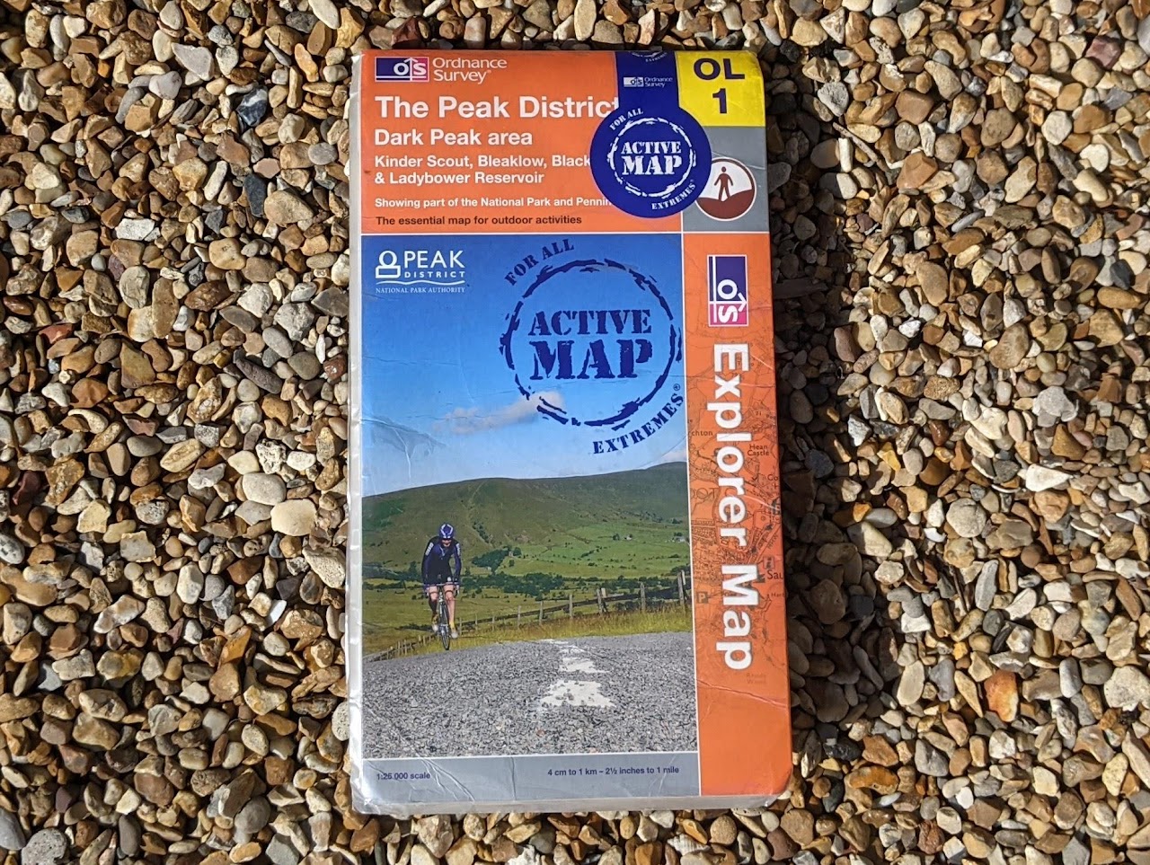
OS Explorer OL1
The 1:25,000 OS Explorer map of The Peak District is a must-have when visiting the Dark Peak Area.
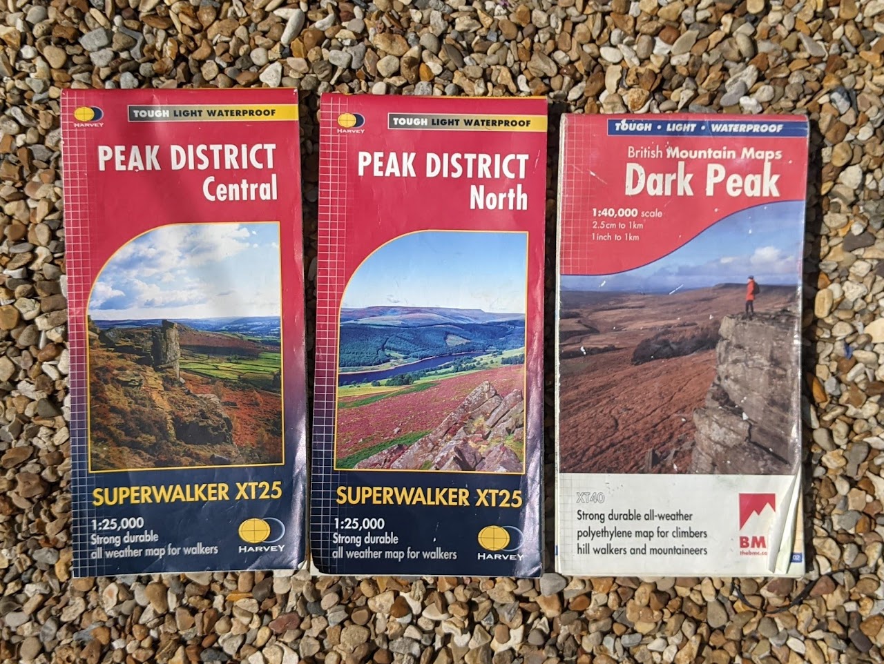
Harvey Superwalker XT25 | BMC Dark Peak
Also Great maps for anyone wanting to complete this route. The Superwalker XT25 maps are 1:25,000 and the BMC is 1:40,000. The BMC is ideal if you are more familiar with the area or are more confident working with reduced information, if sticking to the route it should be more than adequate.
Harvey Superwalker
XT25 - Peak District North
Harvey Superwalker
XT25 - Peak District Central
BMC Dark Peak
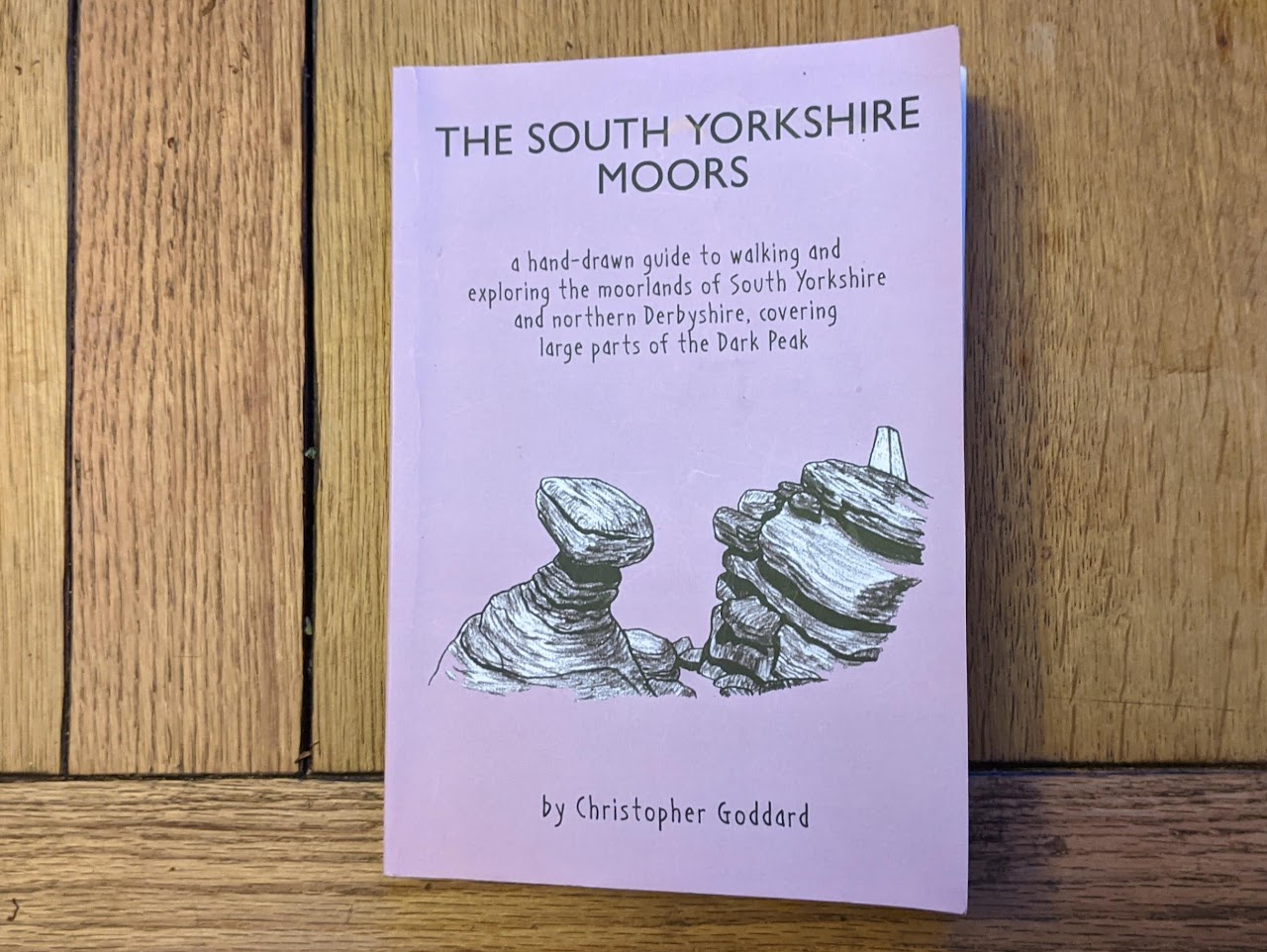
The South Yorkshire Moors
A great book for anyone wanting to explore, or know more about, the Dark Peak. All Chris Goddard's books are beautiful, rich, and interesting reads and I found this volume in particular a superb reference when planning the route. The local knowledge really brings a light to the Dark Peak!